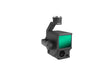
DJI Zenmuse L1
DJI Zenmuse L1 | LiDAR Mapping Payload for Precision Aerial Survey
The DJI Zenmuse L1 integrates a Livox LiDAR module, high-accuracy IMU, and a 1-inch CMOS camera on a 3-axis stabilized gimbal. When paired with the Matrice 300 RTK and DJI Terra, the DJI Zenmuse L1 delivers real-time 3D data, captures intricate details of complex structures, and ensures high-accuracy model reconstruction across demanding survey environments.
DJI Zenmuse L1 Key Features
Aerial Surveying Performance
- Integrated LiDAR module, RGB camera, and high-accuracy IMU
- Covers up to 2 km² in a single flight for high-efficiency data collection
- Vertical accuracy: 5 cm / Horizontal accuracy: 10 cm
- Point rate: 240,000 pts/s
- Supports 3 returns
- Detection range: 450 m (80% reflectivity, 0 klx)
- IP44 ingress protection for durability in diverse weather conditions
- Point Cloud LiveView for real-time field insights

Livox LiDAR Module and RGB Camera
- Frame LiDAR ensures up to 100% effective point cloud results
- RGB Camera: 20MP, 1-inch CMOS with mechanical shutter
- High-Accuracy IMU: 0.025° (roll/pitch) / 0.08° (yaw) accuracy with vision sensor and data fusion
Real-Time 3D Point Clouds
Create true-color point cloud models in real-time, acquire data across 2 km² in a single flight, and render centimeter-accurate reconstructions using integrated high-accuracy IMU, vision sensor, and GNSS data. Fly at night with confidence using the LiDAR module's active scanning method.
One-Stop Post-Processing with DJI Terra
DJI Terra seamlessly fuses IMU and GNSS data to generate reconstructed models and accuracy reports with POS data calculations — streamlining the entire post-processing workflow.

Compatible Aircraft
- DJI Matrice 300 RTK
- DJI Matrice 350 RTK (payload firmware update required)
Applications
- Topographic mapping and land survey
- Architecture, engineering, and construction (AEC)
- Emergency response and disaster assessment
- Law enforcement and public safety
- Infrastructure management and inspection
- Agriculture and forestry management
Payment & Security
Payment methods
Your payment information is processed securely. We do not store credit card details nor have access to your credit card information.