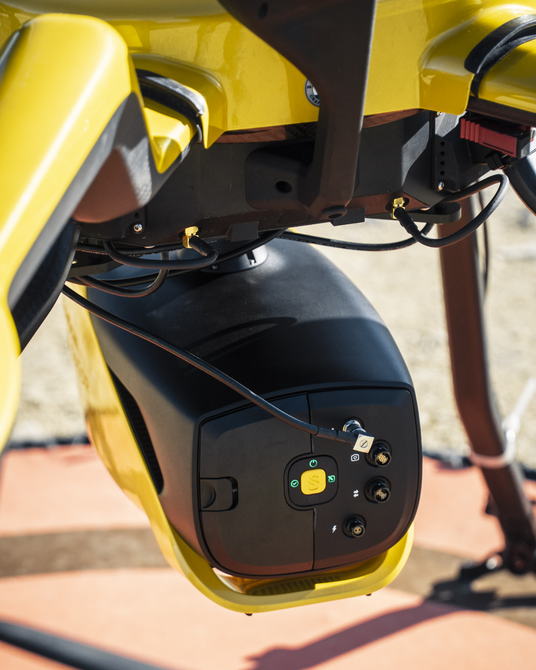
YellowScan Navigator - Advanced Bathymetric LiDAR Solution
The YellowScan Navigator is a lightweight, one-button LiDAR solution for simultaneous land and water surveying. Weighing just 3.7 kg (without battery), it’s ideal for multirotor and helicopter UAVs, delivering high-precision results with up to 3 cm accuracy.
Built around YellowScan’s proprietary laser scanner and the SBG Quanta Micro IMU, the Navigator offers exceptional data quality, a 40° field of view, and an integrated global shutter camera for precise colorization.
It comes pre-calibrated with a GREMSY quick-release mount for fast deployment and includes one year of unlimited tech support plus personalized training—on-site or online.
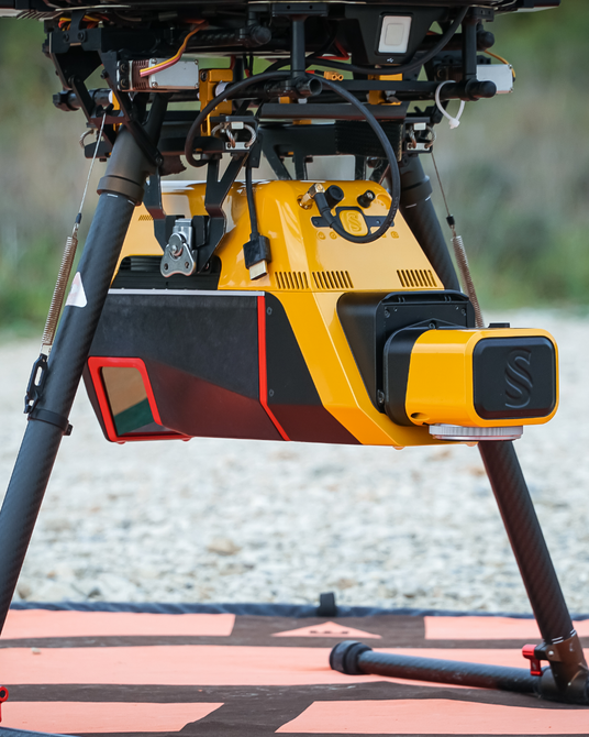
YellowScan Voyager - Precision Meets Performance
The YellowScan Voyager sets a new standard for high-precision LiDAR with a 100° field of view and data acquisition rates up to 2.4 MHz—ideal for projects requiring extreme point density.
Powered by RIEGL and Applanix technology and compatible with YellowScan’s RGB, 20 MP, or 60 MP camera modules, Voyager delivers 0.5 cm precision and 1 cm accuracy at altitudes up to 440 m—all in a lightweight 3.5 kg (battery excluded) design.
Adaptable across multirotor, helicopter, fixed-wing UAVs, and light manned aircraft, it captures up to 2 million usable points per second with exceptional vegetation penetration and vertical surface detail.
A compact, mission-customizable LiDAR solution built for advanced geospatial performance.
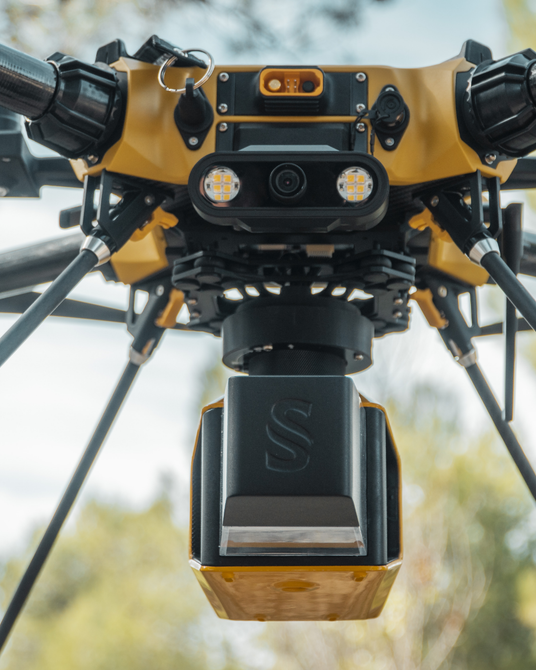
YellowScan Explorer - Versatility in a Compact Form
The YellowScan Explorer is the first compact LiDAR system to combine long-range performance with true multi-platform versatility. Weighing just 1.8 kg (4 lbs) without battery, it delivers 2 cm precision and accuracy at altitudes up to 300 m—powered by YellowScan’s proprietary laser scanner.
Compatible with single or dual RGB camera modules (including optional 20 MP, 35 MP, or 60 MP setups), the Explorer offers up to five target echoes per pulse and supports flight speeds from 5 to 35 m/s—capturing rich, detailed vegetation and terrain data.
A configurable laser PRF enables mission-specific tuning, while the built-in front-facing LCD touchscreen provides real-time system monitoring. Easily deployable on UAVs, helicopters, and light aircraft, the Explorer is engineered for professionals who demand performance without compromise.
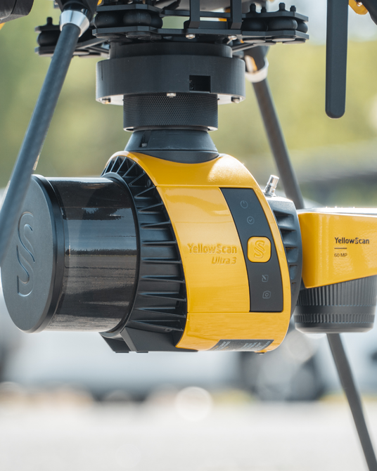
YellowScan Surveyor Ultra - Precision Meets Performance
The YellowScan Surveyor Ultra delivers exceptional value—combining affordability, flexibility, and performance in one compact, turnkey solution. With 32 laser beams and a full 360° field of view, it excels in vertical and mobile mapping, especially when paired with YellowScan’s Fly&Drive system.
Powered by Hesai and SBG Systems technology, the Surveyor Ultra supports RGB camera integration and operates up to 140 m AGL with 3 cm precision and 2.5 cm accuracy. Weighing just 0.98 kg (2.2 lbs), it’s ideal for multirotor, VTOL, and helicopter UAVs.
An embedded global shutter camera enables point cloud colorization, with optional upgrades including 20 MP, 60 MP, or dual 35 MP camera modules for enhanced image capture.
Whether airborne or vehicle-mounted, Surveyor Ultra is built for high-efficiency, multi-environment surveying missions.
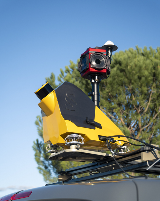
YellowScan Fly & Drive - One System, Limitless Terrain
The YellowScan Fly & Drive is a versatile LiDAR solution built for seamless geospatial data collection across both aerial and ground-based missions. Whether mounted on a UAV or land vehicle, it delivers high-resolution point clouds with 3 cm precision and 2.5 cm accuracy—at speeds up to 50 km/h and ranges up to 200 m.
A custom quick-mount bracket enables fast transitions between drone and vehicle, minimizing downtime and maximizing field efficiency. Compatible with multirotor, fixed-wing, and VTOL UAVs, Fly & Drive offers unmatched operational flexibility—ideal for corridor mapping, urban scans, and rugged terrain.
Accelerate deployment, expand mission capabilities, and reduce ROI timelines with this adaptable, all-terrain LiDAR solution.
Vx Series
-

Vx20 Series
The Vx20 is the premier system in YellowScan’s Vx series, engineered for high-altitude flights and fast-turnaround data processing. As the most accurate model in the Vx lineup, it’s built for applications where precision is non-negotiable—making it especially well-suited for civil engineering and detailed mapping projects.
-

Vx15 Series
The YellowScan Vx15 is your go-anywhere LiDAR solution—ready to map everything from remote Balinese mountain ranges to isolated Chilean valleys. Compact yet powerful, this system combines Applanix and RIEGL technology with RGB camera compatibility to deliver exceptional data quality in hard-to-reach environments.
Mapper Series
-

Mapper+
Small in size but mighty in capability, the YellowScan Mapper+ delivers advanced performance in one of the most compact LiDAR survey solutions on the market. As the lightest system in its class to support three returns and high-density point clouds, the Mapper+ is ideal for agile missions where speed, precision, and portability are key.
-

Mapper
The YellowScan Mapper is your gateway to professional-grade LiDAR—redefining ease of use and accessibility without compromising performance. Purpose-built for newcomers and experienced surveyors alike, it combines low weight, mid-range capability, high point density, and reliable accuracy to deliver the best value for investment.


