
Scanfly EVO | Entry-Level LiDAR Mobile Mapping Solution
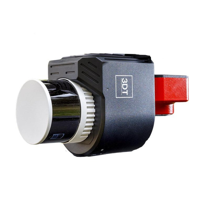
The Scanfly EVO is 3DT's entry-level LiDAR mobile mapping solution, building on a legacy that began in 2016. Designed to capture reality with unprecedented ease and precision, the Scanfly EVO features the Applanix APX-15L INS, a multi-constellation RTK GNSS receiver, and a multi-sensor interface supporting 24–62 MP Sony cameras alongside a 60.5 MP 360° panoramic camera.

Whether walking, driving, or flying, the Scanfly EVO delivers a seamless, tool-less, and cable-free mapping experience. Ground control points, a strip alignment tool, and SLAM technology empower users to achieve precise mapping outcomes across indoor and outdoor environments.
Scanfly EVO Key Features
- INS: Applanix APX-15L for high-accuracy positioning
- Multi-constellation RTK GNSS receiver for precise data capture
- Carry case included for easy transportation
- Multi-platform compatibility with tool-less mounting accessories and cable-free design
- Multi-sensor interface with 24–62 MP Sony cameras and a 60.5 MP 360° panoramic camera
- Ground control points, strip alignment tool, and SLAM enabled for precise mapping
- CE Marked and IP55 certified for durability and environmental protection
Built to Last
The Scanfly EVO is built for demanding survey environments. Its robust CE-marked and IP55-rated construction certifies durability and protection against dust and water ingress — whether navigating the complexities of indoor environments or the challenges of outdoor terrain.

Ideal Applications
- UAV-based LiDAR mapping and surveying
- Mobile ground-based mapping and scanning
- Indoor and outdoor 3D data capture
- Infrastructure and corridor surveys
- Environmental and terrain mapping
Payment & Security
Payment methods
Your payment information is processed securely. We do not store credit card details nor have access to your credit card information.